No products in the cart.
₹3
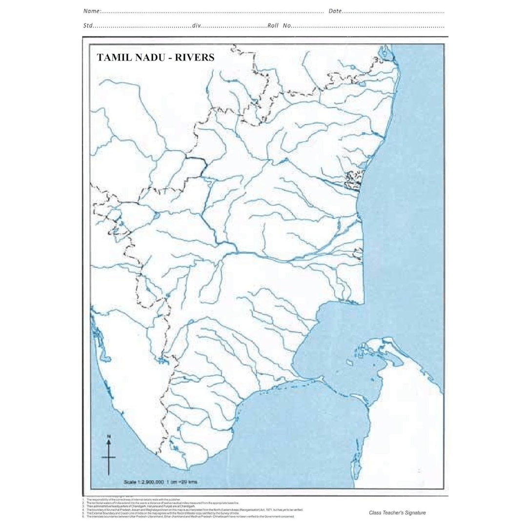
A Map is a visual representation of an area, showing physical features, political boundaries, and other significant information. Traditionally printed on paper or created digitally, it help users understand spatial relationships and navigate from one place to another. They can depict cities, countries, continents, or even the entire world, using symbols, colors, and scales to convey information such as elevation, population, climate, and transportation networks.
These are categorized by purpose. It show boundaries and major cities; it illustrate terrain features like mountains, rivers, and deserts; they focus on specific topics such as weather, population, or land use. Topographic provide detailed information about the Earth’s surface, using contour lines to indicate elevation.
| Weight | 50 g |
|---|


Reviews
There are no reviews yet.